blah blah blah
Moose Mountains Reservation
Length: 3.6 mile loop with out-and-backDifficulty (click for info): Easy
Elevation Gain: 1030 feet (+70 feet on return)
Rating (click for info): 7/10
Elevation: 1216' (Beauty Ledge) and 1185' (Phoebes Nable)
Prominence: 195' (Phoebes Nable)
Driving Directions:
Trailhead and parking area are on New Portsmouth Road in Middleton, NH. From Rt. 153, 0.6 miles southwest of the junction with Rt. 125 in Union, turn northwest onto Ridge Road. Drive 1.2 miles and turn right onto New Portsmouth Road just after a sharp left curve. Continue 1.3 miles (the road narrows and turns to dirt after about 0.7 miles) to the trailhead and end of the road, located just after the last house, where there are spaces to park on the right. Click here for a Google map.
Trail map
About the Hike:
Copple Crown Mountain and the Moose Mountains make up a small and isolated range in the southeastern Lakes Region, just northwest of the center of Wakefield. While very minor in elevation (below 2000'), this little range appears quite prominent when seen from afar. While the two peaks of the Moose Mountains themselves are trailless, a well-kept network of trails within the Forest Society's Moose Mountains Reservation occupies their eastern slopes. The scenery within this property is diverse, ranging from historical sites to quiet ponds to ledgy viewpoints, and one could easily spend an entire afternoon exploring its various features. The hike described here takes in a good mix of the places to see in the reservation.
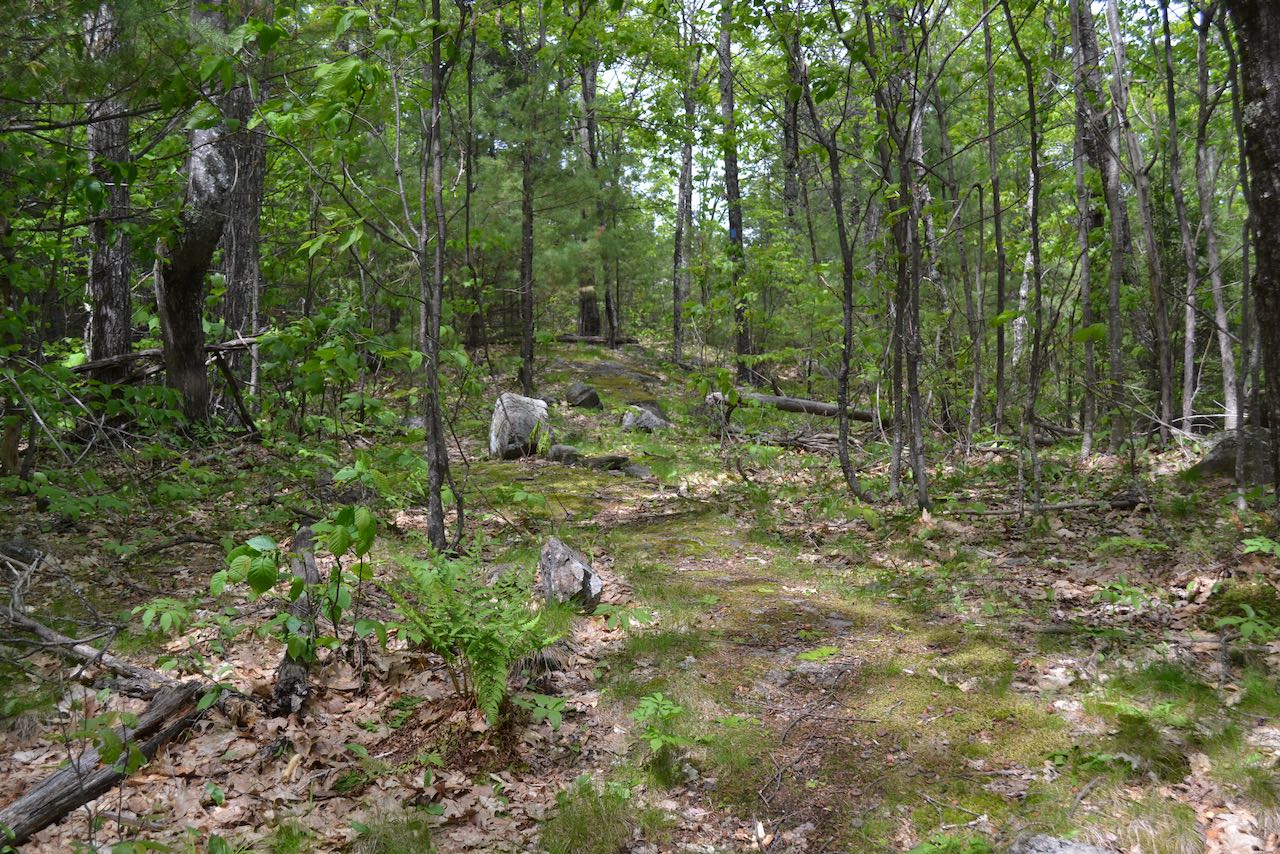
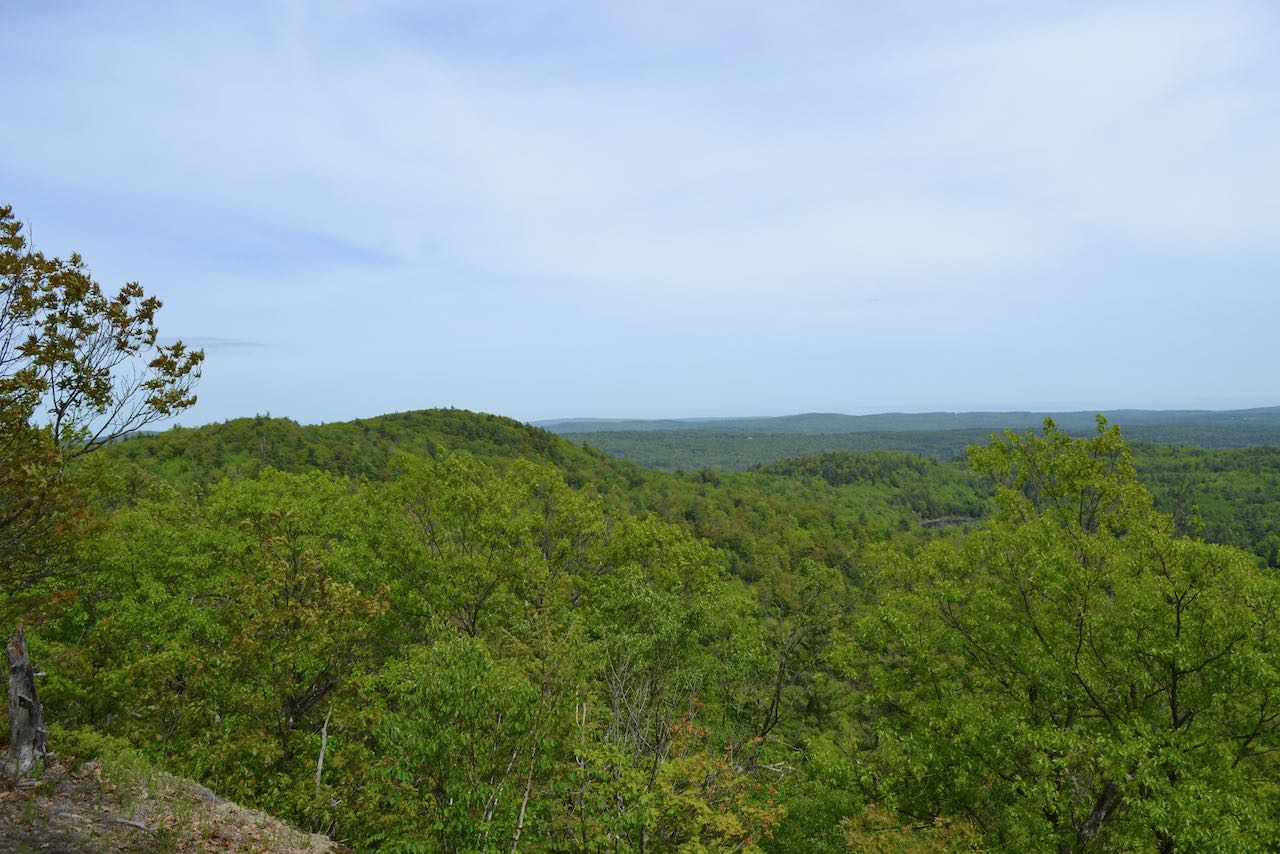
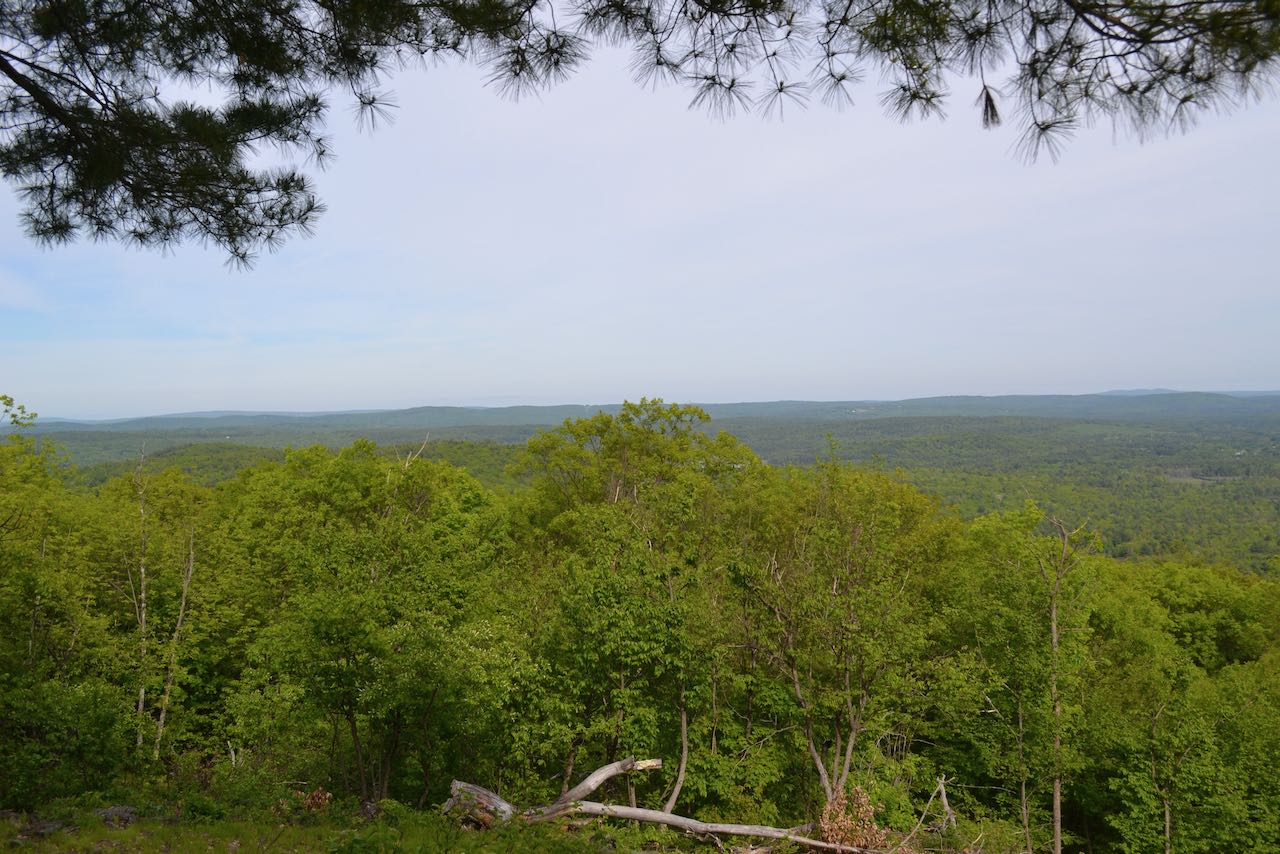
From the parking area, walk up the continuation of New Portsmouth Road (shown on the map as Burrows Farm Trail), paralleling a stream on the right. In 0.35 miles, turn right onto another gravel road, signed as "North Trail". Follow this road 0.15 miles out into a clearing and bear left as another road (Piper Mountain Trail) diverges on the right to lead 0.4 miles down to Bowser Pond. Continue on the North Trail road as it climbs a mild hill for 0.15 miles, then levels off and reaches a junction with Beauty Ledge Trail, which enters the woods on the left. Turn left onto this trail and begin a moderate uphill climb on the lower slopes of an eastern knob of Moose Mountain through pleasant open woods near an old stone wall. In about 0.15 miles, pass by a large boulder on the side of the trail that is labeled "Snapping Turtle Rock". A quick look will confirm the resemblance. As you continue climbing, you will pass beneath the cliffs of Beauty Ledge and wind across a boulder-strewn slope. In 0.1 miles from the uniquely-shaped rock, the trail reaches a small plateau and swings left to climb steeply up beside the ledge, with a few switchbacks. Reach a trail junction in another 0.1 miles and bear left to stay on Beauty Ledge Trail as you approach the top of the knob above the ledge. The trail tours through the grassy and ledgy environment on the little knoll, then drops to reach the best viewpoint in another 0.1 miles. This open ledge has a nice view over the surrounding flat terrain. You can see the nearby Piper Mountain and Bowser Pond, within the Moose Mountains Reservation, as well as the more distant Teneriffe Mountain. The Blue Hills can also be seen further off to the west.
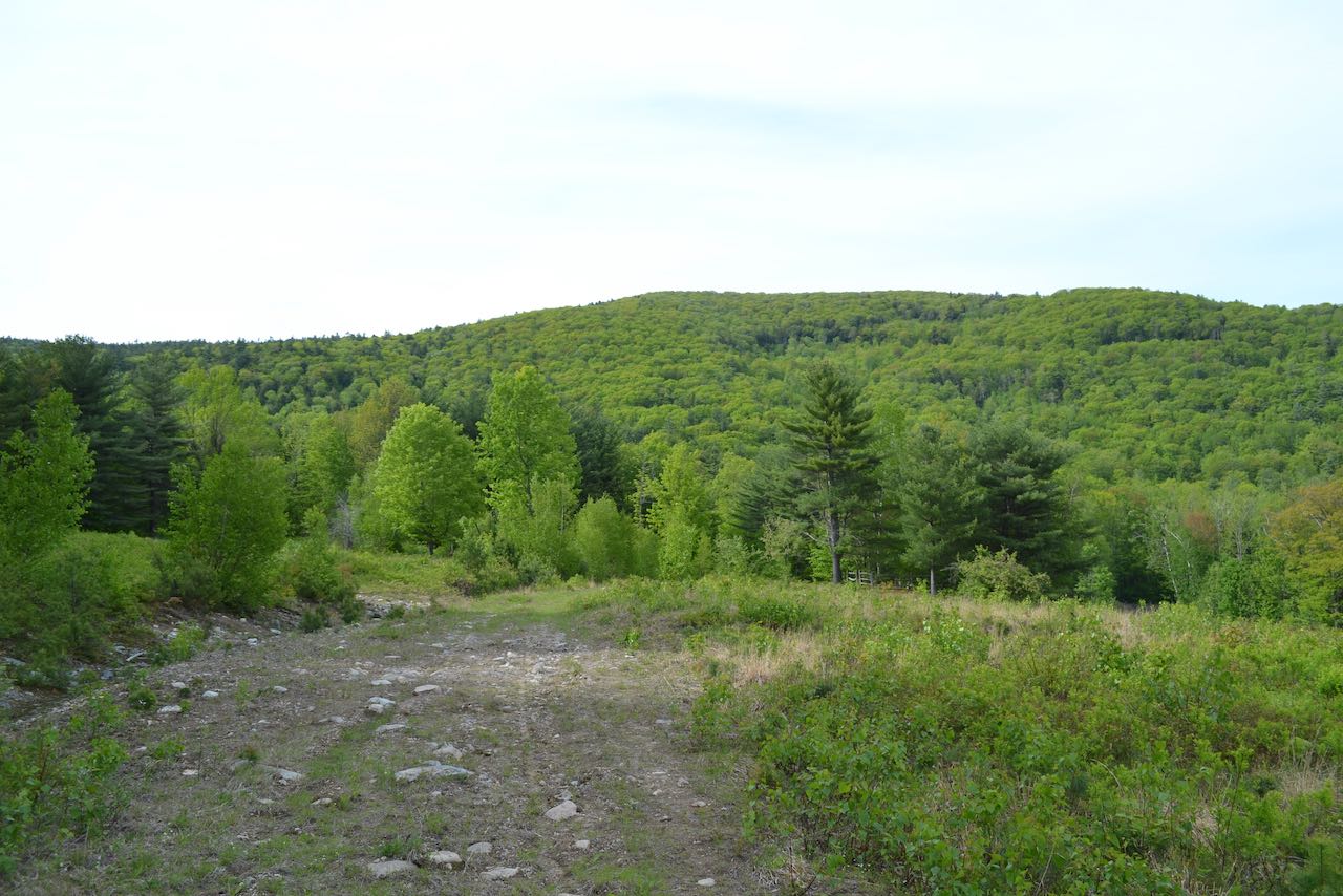
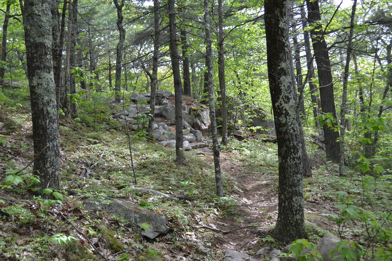
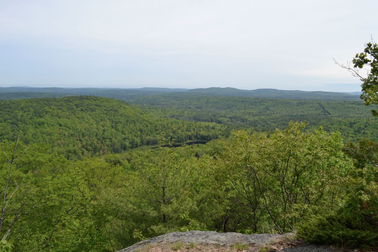
Return the way you came all the way back to the junction of Burrows Farm Trail and North Trail (this was where you turned right 0.35 miles from the parking lot). Turn right to continue on Burrows Farm Trail (left is the way you originally came), and follow the road up a slight incline, near the brook. After 0.3 miles, the road crosses a bridge over the brook and continues 0.2 miles further to a junction. Ahead, the road continues as Moose Mountains Trail. This more strenuous hike leads 0.8 miles up to the ridgetop of Moose Mountain, where there is an extensive ledgy area with a pitch pine community and limited views. Turn left to stay on Burrows Farm Trail and follow it just over 0.1 miles into a large open field, where the trail passes by a plaque marking the site of the Burrows Farm, along with the Burrows Cemetery. Looking ahead over the clearing, you can see the minor hill of Phoebes Nable Mountain, which will be your final destination. Continue on the old road across the field for another 0.1 miles, then fork left onto the Phoebes Nable Loop. This trail leads toward the edge of the field and enters the woods. It goes slightly uphill, then swings left and runs across the hillside before making two great, sweeping turns on gentle grades with well-constructed stone steps to attain the summit after 0.6 miles. At the top, you will arrive in a clearing with a nice view to the south, overlooking a similar scene to what you saw from Beauty Ledge. The trail continues past the summit and descends moderately straight downhill for a quarter mile, then swings right and angles downward across the hillside for 0.2 miles more before making a final switchback and bringing you back to the parking area in another 0.1 miles.
Printable directions page